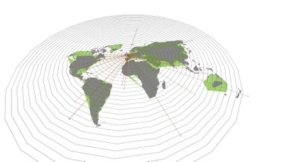
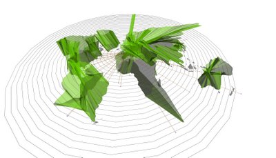
The development of this plan up to this point is shown below.
Screenshots:


Keyframes:

Keyframe 0: Geographic (or actual) configuration with green continents beginning to emerge.

Keyframe 1: Continents begin to morph into the travel-time plane as they are extruded from the geographic map.

Keyframe 2: New shapes of landforms begin to take shape-- a new surface is defined.

Keyframe 3: End. Full extrusion and fully-morphed travel-time surface.
There is still much to be done. As I'm sure is obvious from the keyframes above, a good deal of clarity was lost in the extrusion. I hope to find a clearer way to render and animate this. The distinction between the two planes (true location and time location) needs to be emphasized in some way. Also, animating the emanating lines is yet to be done, as well as continuing the entire process with hubs at Tokyo and NYC. (I have chosen London, Tokyo, and NYC, because they are considered to be "global cities," also they are far enough apart (geographically) so that significant comparisons may be made.)
Animation:

No comments:
Post a Comment